
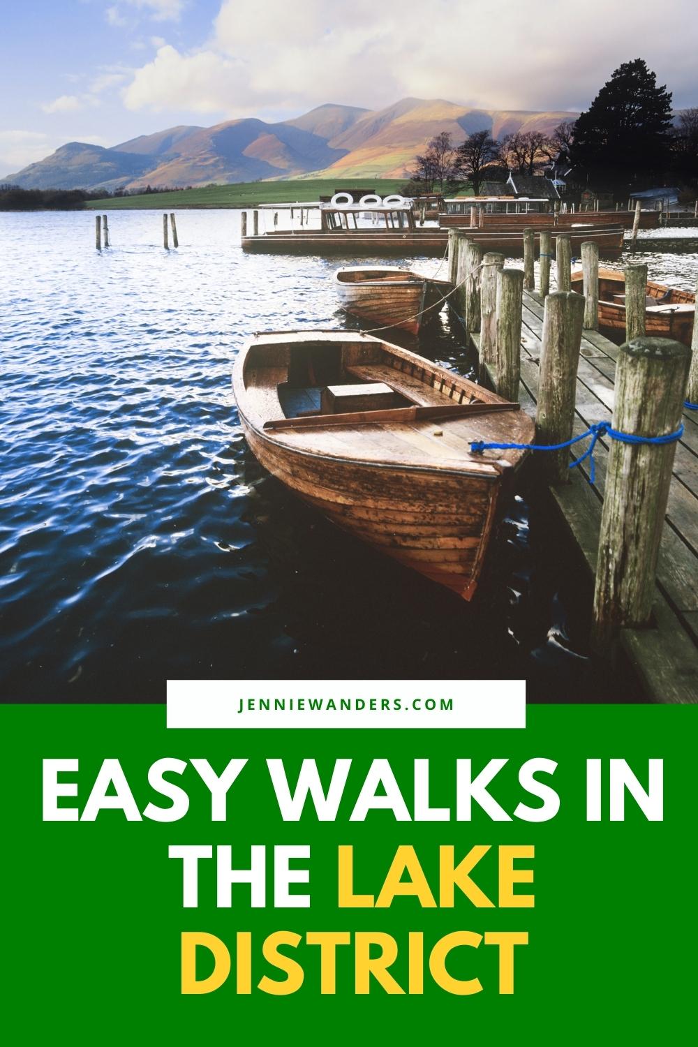
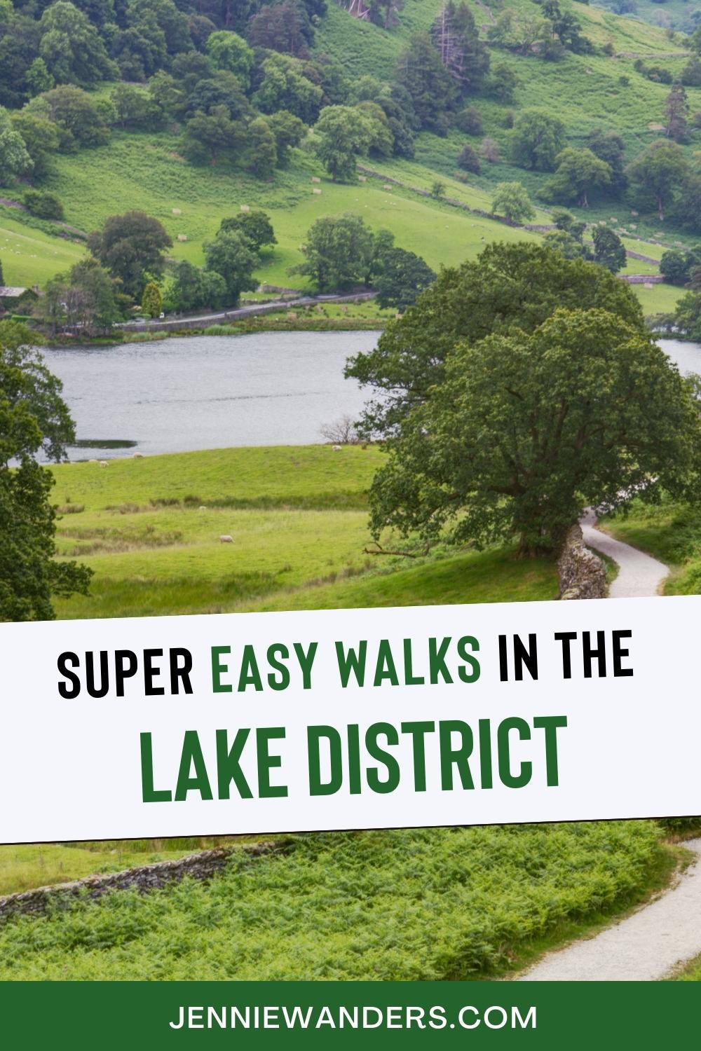
12 Easy Walks in the Lake District With AMAZING Views!
Some links in this post contain affiliate links. I receive a small commission if you use the links at no extra cost to you! Happy reading 😀
Looking for some easy walks in the Lake District? You’ve come to the right place. If you’re looking for a walk in the Lake District that doesn’t have strenuous uphill climbs, take hours to complete, and is just perfect for after a Sunday Roast, I’ve got you covered.
As huge fans and regular visitors of the Lake District, we have completed more easy walks than I can count. And I’ll be honest, some of the best easy walks are simply from finding a trail or path somewhere unexpected.
But there are of course some easy walks that are well-known, or easy to access and pinpoint. And that’s what this post is for.
At a glance, the best, easy walks in the Lake District include:
- Tarn Hows (accessible for all)
- Blea Tarn (accessible for all)
- Latrigg (accessible for most)
- Ravenglass Roman Bathhouse (accessible for all)
- Grizedale Forest (accessible for all)
- Aira Falls (accessible for most)
- Castlerigg Stone Circle (accessible for all)
- The Rydal Waterfall (accessible for all)
- Butteremere circular walk (accessible for most)
- Stock Ghyll Force (accessible for most)
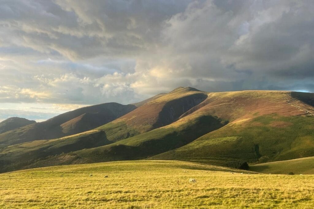
- Cat Bells (moderate hike)
- Helm Cragg (moderate hike)
- Loughrigg Fell (moderate hike)
A quick guide on how to use this post:
Green (easy)
You only need minimal fitness levels for these easy Lake District walks. Flat or very low incline walk, usually a shorter distance, and takes under an hour to complete. Dog-friendly, wheelchair friendly, pushchair friendly… easily walked by everyone and anyone.
Amber (easy-moderate)
Average fitness levels are required for these Lake District walks. Mainly flat terrains but with some slight uphill climbs. Can be walked by most people (including those with a fear of heights).
Red (moderate)
Average fitness levels are required for these Lake District walks. Some harder inclines and uphill walking throughout.
The 12 best easy walks in the Lake District
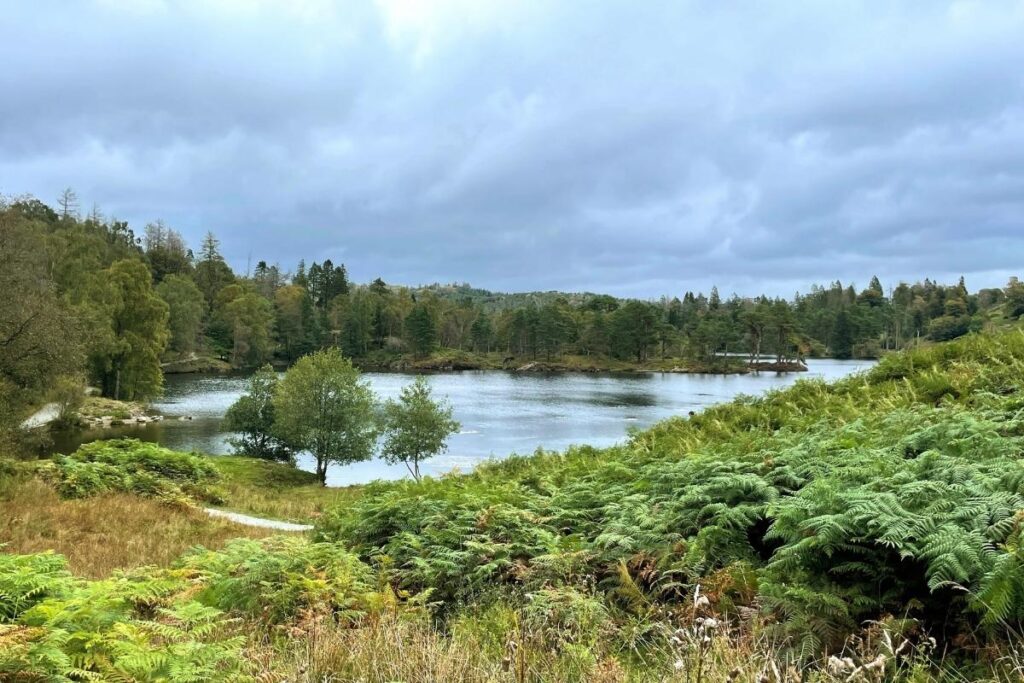
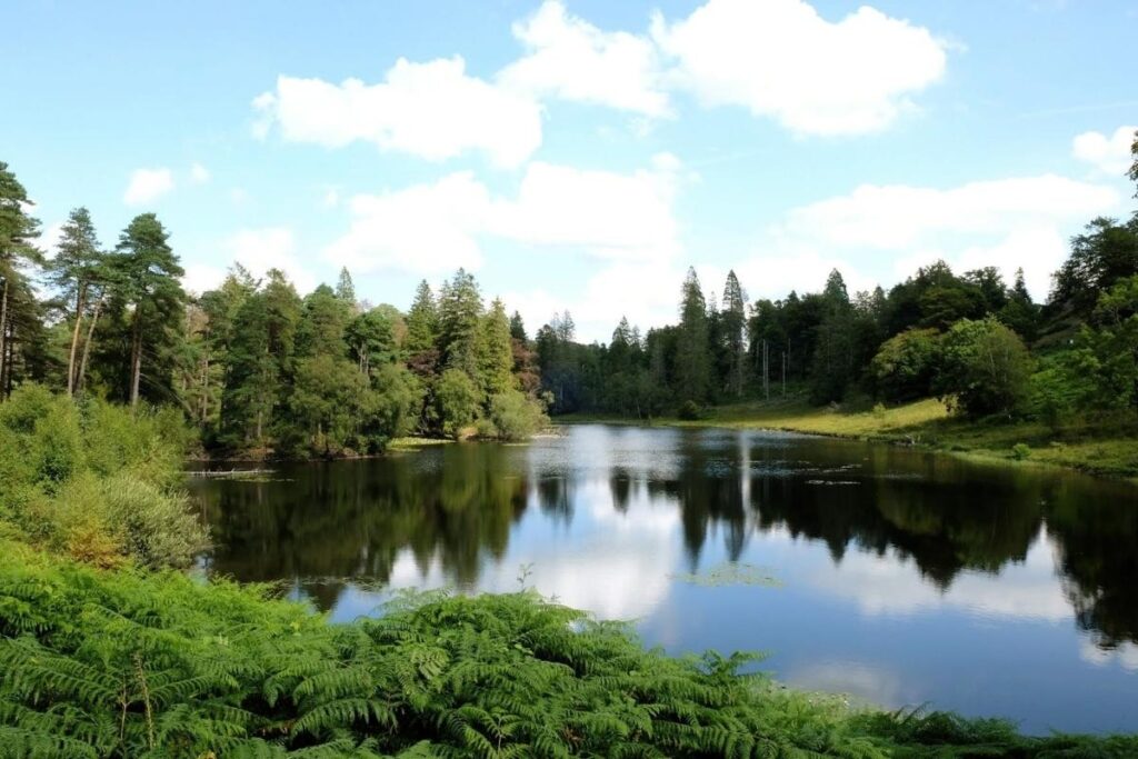
1) Tarn Hows Circular Walk
Green (easy)
🥾 Distance: 3.2km / 2 miles
⏰ Time: 1 hour
🗺️ Postcode: LA22 0PW
🏘️ Closest village: Coniston
- SUMMARY
One of the best easy walks in the Lake District National Park is the Tarn Hows circular loop. We love this route as it can be completed in under an hour, and it’s suitable for all members of the family (including grandparents).
The man-made tarn, which was originally three smaller tarns, was created in the 19th century and is now a popular spot for families and nature lovers due to its easy terrain.
The trail starts just a short walk away from the main National Trust car park.
If you do want to explore more of the area, you can go off the beaten track and further into the surrounding forest area. Although the tarn cannot be swam in due to scientific research, it’s one that can be easily appreciated from the sidelines!
- TERRAIN
Tarn Hows can be completed by anyone and requires minimal fitness. The path circles the tarn and starts directly from the National Trust car park.
There are plenty of benches and large grassy areas for you to stop on the circular route and take a break or lay out the picnic blanket and have some lunch. It’s a great start for an easy Lake District walk, and I’ve written a whole guide about walking Tarn Hows here!
- FINAL NOTES ON TARN HOWS
Dog-friendly, wheelchair friendly, toilets are located in the main car park. No wild swimming is allowed and there are no food or drink points, so take your own snacks and water.
Check out the Tarn Hows Lake District National Park map here.
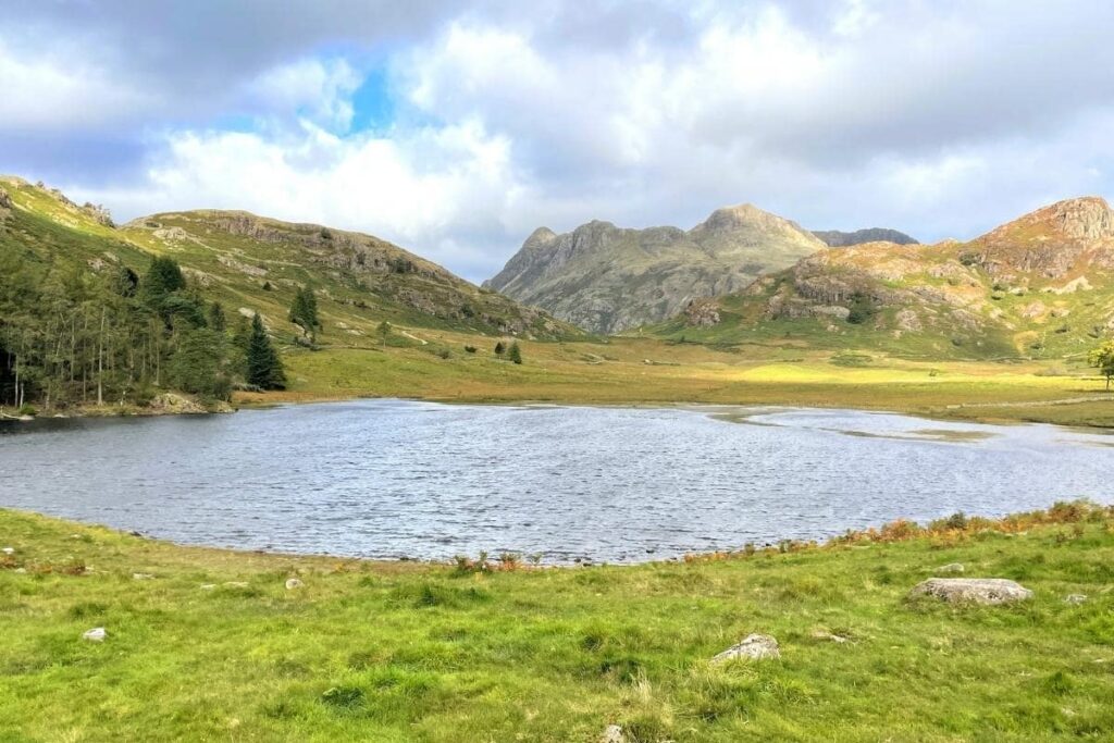
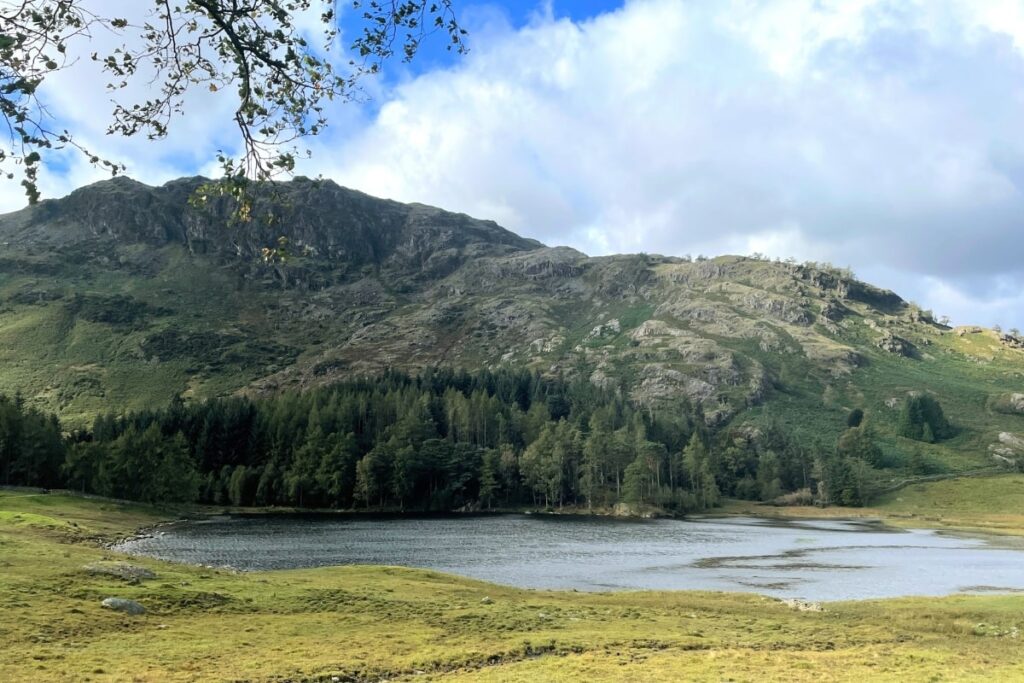
2) Blea Tarn
Green (easy)
🥾 Distance: 2.9km / 1.8 miles
⏰ Time: 1 hour
🗺️ Postcode: LA22 9PG
🏘️ Closest village: Coniston/Grasmere
- SUMMARY
Another easy circular walk in the Lake District is the route around Blea Tarn. We love Blea Tarn as it’s super easy for beginners who want to enjoy the Lake District countryside without breaking a sweat!
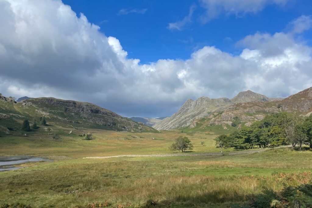
Blea Tarn is a small but stunning glacial lake tucked away in the Langdale Valley of the Lake District, with breathtaking views of the Langdale Pikes and surrounding fells.
It’s a popular stop for photographers and hikers, as its serene and dramatic setting has super easy access (it’s a 30-second walk from the car park!) We have spent many mornings walking around Blea Tarn, and have enjoyed it in all types of weather (including rain!)
It’s one of my favourite easy Lake District walks, and I have an entire guide about walking Blea Tarn here!
Blea Tarn is also close to the start of the Langdale to Scafell Pike route.
- TERRAIN
The walk is one of the easiest to access with a car park directly opposite and has mostly flat or paved surfaces to walk on. However, some of the paths are a bit more rugged than Tarn Hows and can have a few loose stones and rocks that can easily be avoided.
One thing to note when visiting Blea Tarn is the drive to the car park. The road is quite narrow and gets steeper the closer you get to the tarn. For many, this isn’t a problem, but it’s just something to bear in mind when visiting!
- FINAL NOTES ON BLEA TARN
Dog-friendly, wheelchair friendly, no toilets available. Wild swimming allowed! No food or drink facilities.
Check out the Blea Tarn National Park map and Lake District map here.
3) Latrigg Viewpoint
Green (easy)
🥾 Distance: 0.7 miles
⏰ Time: 15-20 minutes
🗺️ Postcode: CA12 4NG
🏘️ Closest village: Keswick
- SUMMARY
Without a doubt, Latrigg is one of the best scenic spots in the Lake District without a strenuous uphill climb. It is a great easy walk in the Lake District. The Latrigg viewpoint is a short 20/25 minute uphill walk (with an easy incline) from the Underskiddaw car park.
Walk alongside grazing sheep and admire the views as you reach the point where you can admire the town of Keswick and Derwent Water from above. I’ll be honest, you’ll be stretched to find another easy walk with such breathtaking views. It’s one of the great easy walks to add to your Lake District itinerary.
- TERRAIN
Even before you reach the Latrigg viewpoint, you will see mountains that look like they’re straight off a postcard. The path to the viewpoint has a slight incline, but it is still one of the easiest walks in the Lake District with an incredible view. There is some bumpy gravel but no rocky surfaces, and an uphill gradient throughout (but nothing too strenuous).
- FINAL NOTES ON LATRIGG
Dog friendly. Car park at the start of the walk. No toilets are available. No food or drink facilities.
Check out the Latrigg Lake District map here, or read more about the terrain and route in my detailed Latrigg post here.
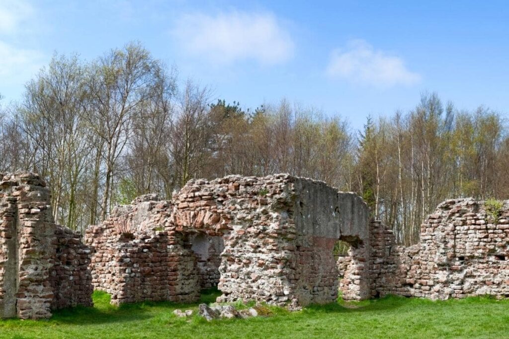
4) Ravenglass Roman Bath House
Green (easy)
🥾 Distance: 2.2km / 1.4 miles
⏰ Time: 1 hour
🗺️ Postcode: CA18 1SN
🏘️ Closest village: Ravenglass
SUMMARY
The Roman Bathhouse is a short and accessible walk that can be completed by everyone. It is in the west of the National Park, and is an easy flat walk in the Lake District. It’s a perfect stop for the end of your trip to the lakes to soak up that last bit of history and culture.
The short easy stroll leads to the remains of the bathhouse of Ravenglass Roman fort, which was established over 2000 years ago. The remains are one of the last largest surviving Roman structures in England, with walls as high as 4 metres!
TERRAIN
The Roman Bathhouse is one of the easy walks in the Lake District and one that can be completed by anyone. The terrain is flat, with either grass, paths or gravel to walk on.
FINAL NOTES ON RAVENGLASS
Dog-friendly, wheelchair friendly. Toilets and refreshments are available in Ravenglass, but none on the route. No incline, craggy edges, or elevation.
Check out the Ravenglass short walk map here.
5) Grizedale Forest
Green (easy)
🥾 Distance: dependable on how long you want to spend in the forest
⏰ Time: 1-2 hours
🗺️ Postcode: LA22 0QJ
🏘️ Closest village: Coniston/Windemere
SUMMARY
The Grizedale Forest in the Lake District is a large woodland area suitable for walkers of all ages, with multiple flat walks. Either take a picnic and enjoy the forest views, or hike up to one of Alfred Wainwright’s smallest fells; Carron Crag. This is in the middle of the forest, and can be avoided if you would like to stay on flatter ground.
There are ten walks in Grizedale Forest to choose from, and you can spend as little as a hour or a whole day exploring the woodlands.
TERRAIN
The terrain is mostly grass, gravel and muddy paths. If it has been raining, be sure to take your wellington boots!
FINAL NOTES ON GRIZEDALE FOREST
Park at the Grizedale Visitor’s Centre. On-site refreshments and catering. Toilets, disabled toilets and changing rooms available. Adventure playground, education and study area as well as a large picnic site.
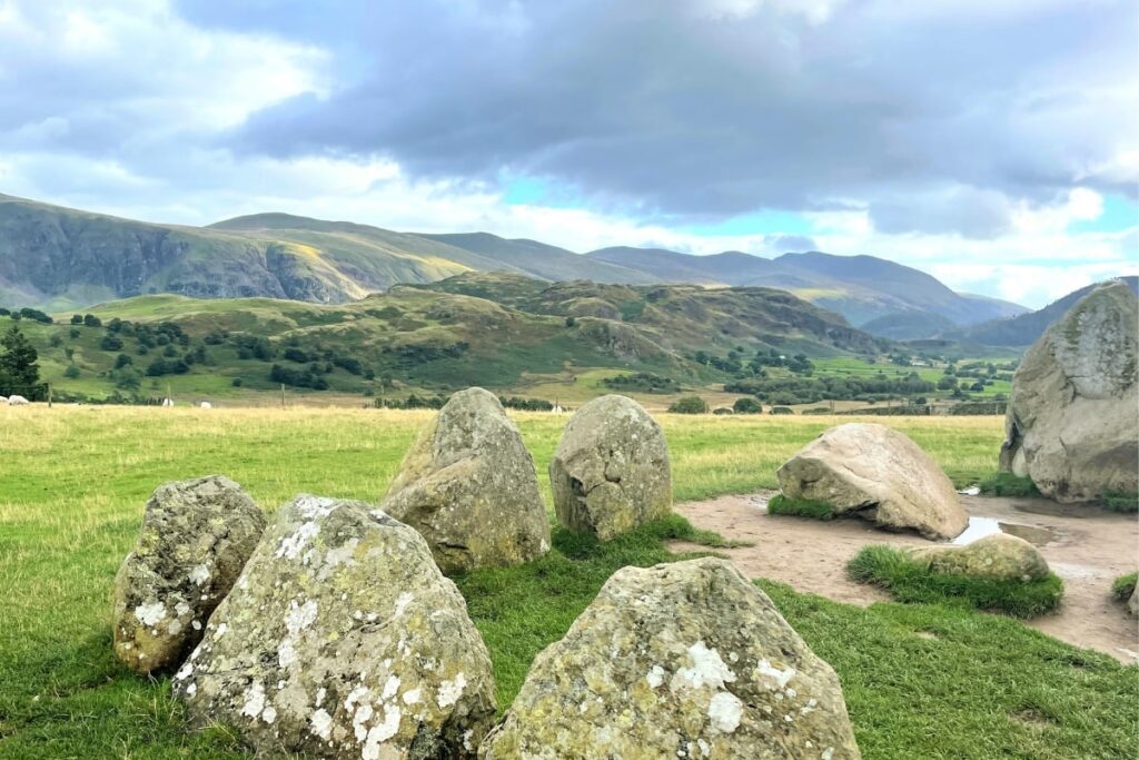
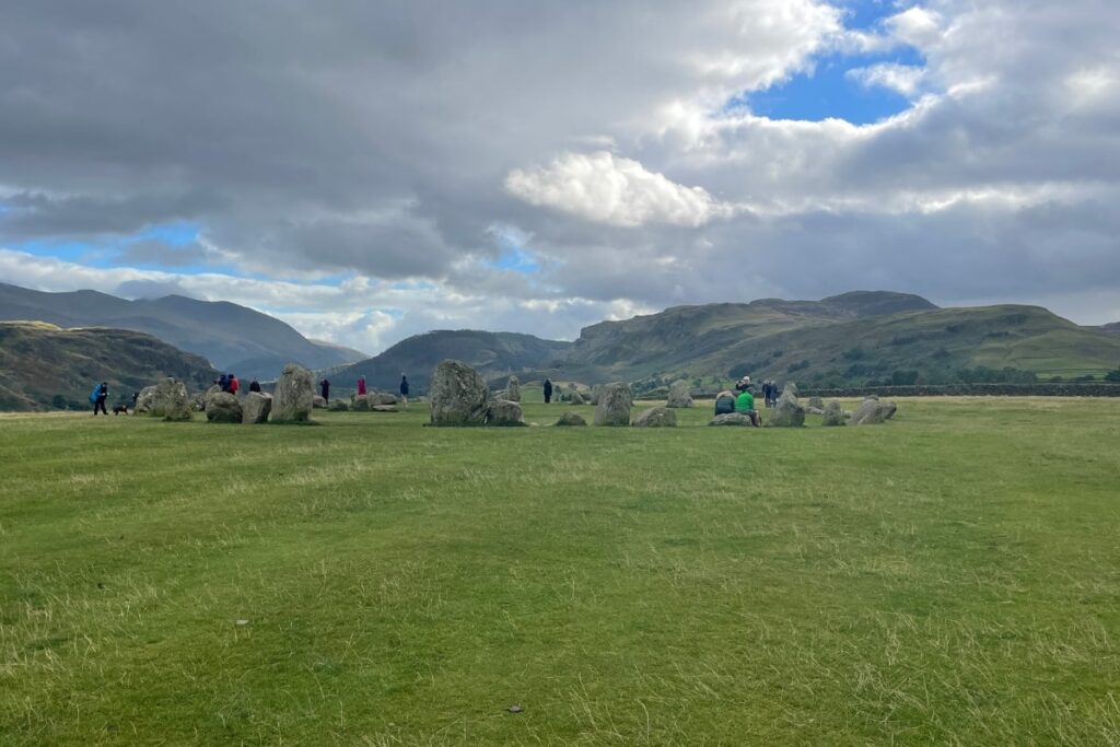
6) Castlerigg Stone Circle
Green (easy)
🥾 Distance: 100m from parking on the street, or 30 minutes from the centre of Keswick
⏰ Time: 15-30 minutes
🗺️ Postcode: CA12 4RN
🏘️ Closest village: Keswick
SUMMARY
Just a five-minute drive from the centre of Keswick is the ancient Castlerigg Stone Circle, which is an easy and flat walk in the Lake District. With panoramic views of the mountainous Lake District and Helvellyn and High Seat in the distance, it’s one of the easiest Lake District walks with incredible views.
Castlerigg is one of the earliest ancient circles in the UK, dating back to 3000 BC. Legend has it that the stone circle was used during the Neolithic times as a ritual of exchanging axes. It also has many other mysteries and stories attached to it.
You can check out more information about the mystical Castlerigg Stone Circle here.
THE TERRAIN
The terrain is one of the easiest on the list, as it is flat grass throughout.
FINAL NOTES ON THE CASTLERIGG STONE CIRCLE
You do not need to stay long at Castlerigg Stone Circle. There is also limited street parking and this can get busy quickly, so many visitors walk from Keswick. There’s also often an ice cream van by the side of the road. No toilets or other facilities are available, apart from at the Keswick Climbing Wall five minutes away. Suitable for dogs and all levels of fitness.
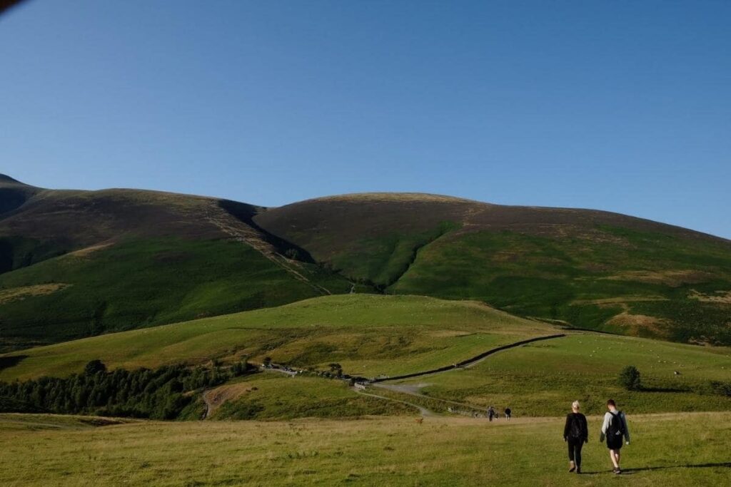
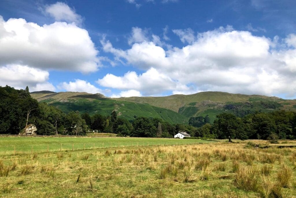
7) Buttermere Circular Walk
Amber (easy-moderate)
🥾 Distance: 7.2 km / 5.4 miles
⏰ Time: 2 hours
🗺️ Postcode: CA13 9XA
🏘️ Closest village: Keswick/Cockermouth
SUMMARY
One of our first easy-moderate walking trails is the beautiful Buttermere circular lake loop. Rated easy-moderate due to its slightly longer distance and gravel terrain, the Buttermere circular walk takes you right around the lake and back again.
This is one of the most popular easy walks in the Lake District, and will take around 2 hours to complete. As the walk can get pretty busy, I’d recommend getting up early and doing the walk in the morning.
Like Latrigg, Buttermere looks best at either sunset or sunrise and has lots of places for you to just pause, think and enjoy the peace and quiet. If you’re lucky, you may spot a wild otter, red squirrel, or deer roaming around the lake, especially if you’ve arrived in the calm before the crowds!
TERRAIN
Start your walk by The Fish Inn, follow the signs for the lake, and begin your route anti-clockwise. The terrain is easy to walk on, but some parts are narrow paths, with loose stone, and gravel. If you have time, stop at the Bridge Inn pub for lunch (and a well-earned pint of beer!). A lovely, easy walk in the Lake District for all!
FINAL NOTES ON THE BUTTERMERE CIRCULAR WALK
Car parks are at both ends of the lake. Dog friendly, wheelchair friendly but with some narrow paths and bumpier terrains. Toilets, food, and drink are available in Buttermere, but none on the route. Wild swimming allowed.
Check out the Buttermere map here.
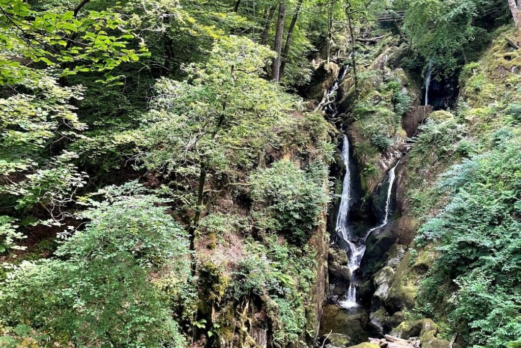
8) Stock Ghyll Force, Ambleside
Amber (easy-moderate)
🥾 Distance: 1.4km / 0.9 miles
⏰ Time: 20 minutes
🗺️ Postcode: LA22 0QT
🏘️ Closest village: Ambleside
SUMMARY
Another easy walk in the Lake District is the scenic short hike up to a 70-foot waterfall. The walk begins just a short distance from the centre of the village of Ambleside, right behind the Salutation Hotel.
It took us around 20 minutes to reach the top of the waterfall from Ambleside, and it was well-signposted and directed by a clear footpath. The easy walk is well worth the views. It’s one of the most scenic routes on the list with a beautiful waterfall view just a short walk away from Ambleside.
TERRAIN
Stock Ghyll is an easy-moderate walk due to a steeper incline than the previous walks, with more difficult terrain including rocky steps, exposed tree roots, and uneven gravel. In the rain, the path will become slippy and muddy. However, a low level of fitness is required to hike Stock Ghyll Force.
FINAL NOTES ON STOCK GHYLL FORCE
Dog friendly. A steep incline with uneven terrain with forest surroundings. No toilets or refreshments are available (but lots of pit stops in the village of Ambleside are only 20 minutes away). Bins and benches are along the path in various locations.
9) Aira Force, Ullswater
Amber (easy-moderate)
🥾Distance: 1 mile
⏰ Time: 1 hour
🗺️ Postcode: CA11 0JY
🏘️ Closest village: Glenridding
SUMMARY
Another easy walk is Aira Force, located in the north of the Lake District. It is one of the most famous waterfalls in the National Park.
The easiest way to see the waterfall is via a 2.1km circular loop, with an adjoining car park for ease of access. The loop is abundant with wildlife and ancient trees, dating back thousands of years. It will take you to the base of the waterfall and back round to the car park.
TERRAIN
It’s an easy walk, but it has a bumpy and uneven terrain. In the rain, the path will become slippy and muddy. Wear suitable shoes and always look at where you are walking; there are many jagged rocks and exposed roots sticking out of the ground!
FINAL NOTES ON AIRA FORCE
Dog friendly. The waterfall is not accessible by wheelchair and suitable footwear is advised. Most of the path is rugged and uneven. Toilets are located in the car park, and a small cafe is also situated near the waterfall serving refreshments.
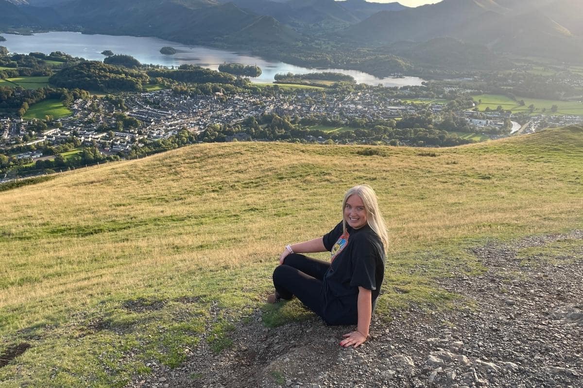
10) Cat Bells
Amber (easy-moderate)
🥾 Distance: 3.5 miles / 5.7km
🗻 Elevation: 451m
⏰ Time: 2 hours
🗺️ Postcode: CA12 5UE
🏘️ Closest village: Keswick
SUMMARY
The Cat Bells walk is one of the easiest yet most scenic walks in the Lake District. The iconic view from the summit overlooks Derwentwater lake and the market town of Keswick. It’s one of the most popular Lake District walks due to it’s easy terrain and incline (however, it will still take about two hours to complete).
Even Alfred Wainright said it himself, and is known to have commented “even grannies and young kids can do it” about the Cat Bells walk!
TERRAIN
The terrain for Cat Bells is a gradual incline on a rocky path, made of gravel. There are some parts of the climb that are bigger rocks, made into the formation of steps. Again, anyone with moderate fitness can complete the Cat Bells walk with ease.
FINAL NOTES ON CAT BELLS
A free carpark is available at the start of Cat Bells near Hawes (postcode CA12 5UE). No toilets or facilities available on the walk. Cat Bells is suitable for dogs.
11) Helm Crag
Red (moderate)
🥾 Distance: 6.4 km / 4 miles
🗻 Elevation: 341m
⏰ Time: 2.5 hours
🗺️ Postcode: LA22 9SW
🏘️ Closest village: Grasmere
SUMMARY
The first of the two ‘red’ easy walks on my list is the wonderful Helm Crag. Definitely harder than the circular tarn loops mentioned previously, but still a lot easier than some of the higher peaks in the area. Whilst the summit only reaches 341m, the view from the top of the crag is beautiful and worth hiking to.
It’s an ascent that takes a bit of physical determination but there are no sheer edges or exposure to drops. This makes it a perfect climb for a great viewpoint at a higher altitude.
TERRAIN
The walk isn’t too exposed and has a lot of greenery surrounding you at all times (perfect for those with a fear of heights). You will need a basic level of fitness to complete the walk due to the steeper incline of the path. Most of the path is gravel and rock.
LANDSCAPES AND VIEWS
You’ll be able to see the point of Helm Crag from the ground in the small village of Grasmere, due to its notable rocky edge. Most of the walk is sheltered by trees and plants, so there are no sheer edges or drops. The best views of Grasmere are near the summit.
THE SUMMIT
You will need to do a tiny bit of scrambling over some rocks to the highest point on Helm Crag. The path is quite steep and you will have to step over some larger boulders to reach a good viewpoint. However, you can stop just below this and still see some of the views of the Lake District. If you have a clear view of Grasmere and the surrounding areas from the summit, the scenery looks just like Canada or New Zealand!
Need more information on the Helm’s Crag walk? Check out my detailed guide here.
FINAL NOTES ON HELM CRAG
Dog friendly. Not accessible for wheelchair users or pushchairs. A steep incline with rocky edges and uneven terrain. No toilets or refreshments on route. Suitable outdoor shoes are needed.
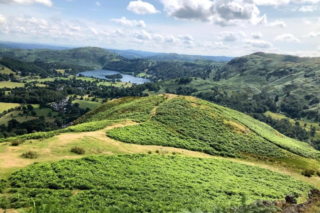
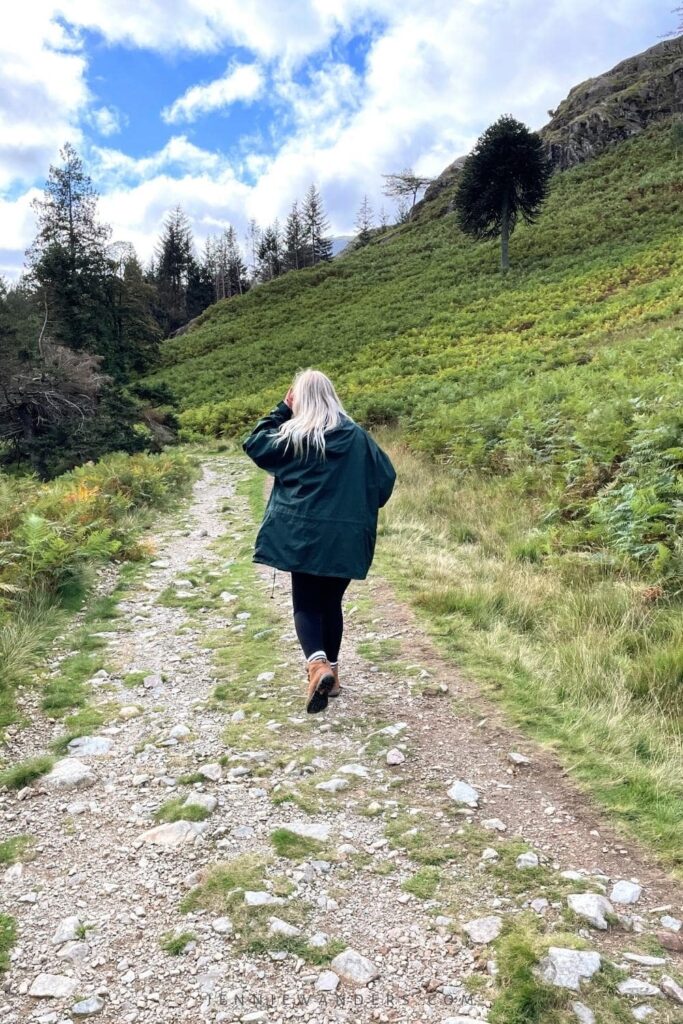
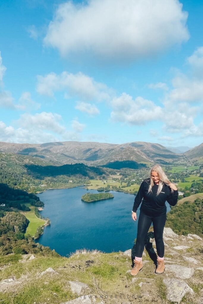
12) Loughrigg Fell
Red (moderate)
🥾 Distance: 10.5 km / 6.5 miles
🗻 Elevation: 341m
⏰ Time: 4 hours
🗺️ Postcode: LA22 9SB
🏘️ Closest village: Ambleside
SUMMARY
The final ‘red’ walk on my list is Loughrigg Fell, which can take up quite a few hours of your day. Known for being one of the easier, but more extensive, walks to do in the Lake District, the route starts from Ambleside Church and has a distance of around 6.5 miles (10.5 km). We finally got around to doing the Loughrigg Fell walk last year, and it’s now one of my favourite walks in the Lake District!
You do need a basic level of fitness, and a steady head for heights to take on some of the steeper sections; however, I’m not great with heights and I was still able to do it. There are also a few ‘false summits’ near the top of the fell. However, it is one of the easier circular walks in the Lake District.
TERRAIN
The terrain differs throughout the Loughrigg Fell walk. You’ll start on paved gravel, and move onto grassy terrains with sporadic rocks pointing out of the ground. At some points of the hike, you will need to climb up boulders and across rocky edges.
LANDSCAPES
You’ll stroll around tarns, rolling hills, and even have a view of Grasmere and Rydal Water from a high vantage point. I’ve scored Loughrigg Fell as a red route due to its altitude reaching 360m and the loop taking around 4 hours (and even longer if you keep stopping for photos).
THE SUMMIT
The final summit has a few rocks to sit on and take in your surroundings, although it can get windy and you might want to start your descent sooner rather than later! From the top, you will be able to spot Lake Windermere, Loughrigg Tarn, and the Langdale Valley, with parts of Grasmere and Elterwater.
If you’re descending via Grasmere (instead of going back on yourself), be sure to add in a trip to the Rydal Caves afterwards!
Loughrigg Fell is a beautiful, easy walk in the Lake District. I’d recommend Loughrigg Fell to anyone who doesn’t like strenuous hikes up high altitudes. As I said, it’s a ‘red’ walk, but it’s still one of the easier walks to do in the Lake District!
Need more information on the Loughrigg Fell walk? Check out my detailed guide here.
FINAL NOTES ON LOUGHRIGG FELL
Dog friendly. Not accessible for wheelchair users or pushchairs. A steep incline with rocky edges and uneven terrain. No toilets or refreshments on route. Suitable outdoor shoes are needed.

Easy walks in the Lake District: FAQs
1) What is the easiest walk in the Lake District?
Tarn Hows and Blea Tarn are two of the easiest yet most scenic walks in the Lake District. Both walks are flat and can be completed by anyone with any fitness level. If you’d prefer to gain some elevation, head to Latrigg. For a short 15-minute walk from the car park, you’ll be rewarded with some of the best views of the Lake District.
Fancy seeing the Lake District caves that are over 200 years old? The Rydal Caves are a great, easy walk in the Lake District, and can either be added onto a Rydal, Ambleside or Loughrigg Fell walk. Or, head there in the morning and have a picnic! Need more info? Check out my detailed Rydal Caves travel guide here.
2) What is the most beautiful hike in the Lake District?
There are a number of beautiful hikes in the Lake District, but Latrigg is one of the most beautiful easy hikes. Just a short 15-minute walk from the car park, the Latrigg viewpoint has some of the most beautiful views in the entire National Park.
3) What is the least touristy part of the Lake District?
The further out of the National Park (and away from villages like Ambleside, Windemere and Bowness) will be the least touristy areas. If you stay in one of the towns just outside of the National Park (like Ulverston), you will be around fewer tourists than in the centre.
If you want to save some money on accommodation, Ulverston is a short drive out of the Lake District National Park. But, it is still one of the prettiest villages in the surrounding areas and in this Lake District area guide!
Beautiful Ulverston accommodations:
- If you’re travelling to the Lake District in a group, check out The Stables’ three-bedroom house. It’s cosy, has its own garden and BBQ for you to use, and is close to the town centre. ➡ BOOK THIS COTTAGE NOW!
- A cottage suited more for couples is Sunnybank. It’s cosy and comfortable, and has its own outside space for you to enjoy! ➡ BOOK THIS COTTAGE NOW!
4) What are the best maps for walking in the Lake District?
If you are doing any kind of walking or hiking in the Lake District, you will need Ordnance Survey OS Explorer maps. Most of the hikes are not signposted and Google Maps is not accurate on mountain trails. The OS Explorer maps cover the whole of the Lake District but are broken down into different areas. Make sure you buy the right map for the area you would like to hike in.
➡ Buy your Lake District Ordnance Survey OS Explorer maps now!
5) What is the cutest village in the Lake District?
Ambleside is known as one of the prettiest and ‘cutest’ villages in the Lake District. With traditional grey-slate buildings, cobbled houses, picturesque views, pubs, shops and restaurants, Ambleside is the cutest and best location to stay in the Lake District for first-timers.
6) When is the best time to visit the Lake District?
You can visit the Lake District 365 days a year; as it’s an ‘any kind of weather’ destination in the UK. However, if you want the cheapest accommodation prices, visit in the shoulder season (autumn and spring). During the winter months (November – February), you can expect layers of snow to be covering the trails and paths.
Summer months in the UK (June – August) are always the most expensive months to visit the Lake District, as well as being the busiest. But of course, it’s when you’ll get the best weather, with dry, hot and sunny days.
➡ Visiting the Lake District in winter? Check out this detailed guide on what to do during the colder months.
7) What to pack for the Lake District
If you’re visiting the Lake District for the first time, I recommend packing:
- A lightweight waterproof jacket
- Hiking boots
- An umbrella
- A waterproof day bag
- A waterproof phone case
- A portable charger
- Lots of layers
- A GoPro for waterproof camera footage
- A waterproof backpack cover
- A chilly bottle to keep your water at a drinkable temperature
- A Dry Robe, as it helps to keep you warm when entering and leaving the water (even when it’s raining)
- As well as using bug spray, we have midge-repellent wristbands.
Easy Walks in the Lake District: In a Nutshell
So, there you have it! Everything you need to know about the easy walks in the Lake District. When you’re planning a trip to the Lake District and are looking for some Lake District easy walks, make sure you let me know over on Instagram or in the comments below!
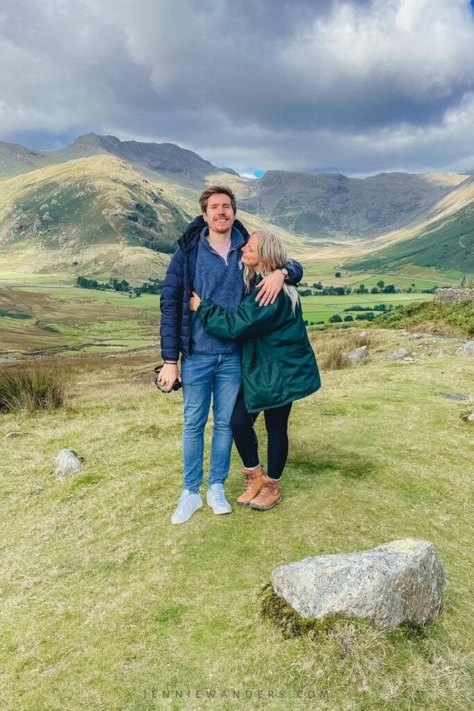
If you haven’t seen my blog before, I write posts aimed at first-time backpackers on a budget. I’m currently travelling around the world with my boyfriend (read more here!), creating guides and itineraries for you to follow in our footsteps!
Keep an eye out for more Lake District content, all written from a personal and realistic point of view. You can sign up for my newsletter and juicy travel updates here!
As always, thanks for reading and supporting the blog!
Happy travelling 🙂
Jennie x
Other posts for travelling the UK:
- Wild Swimming in the Lake District: The Best Spots
- Where to Stay in the Lake District: An Area Guide
- 10 EPIC Things to Do in Grasmere, Lake District
LIKE THIS POST? PIN IT!
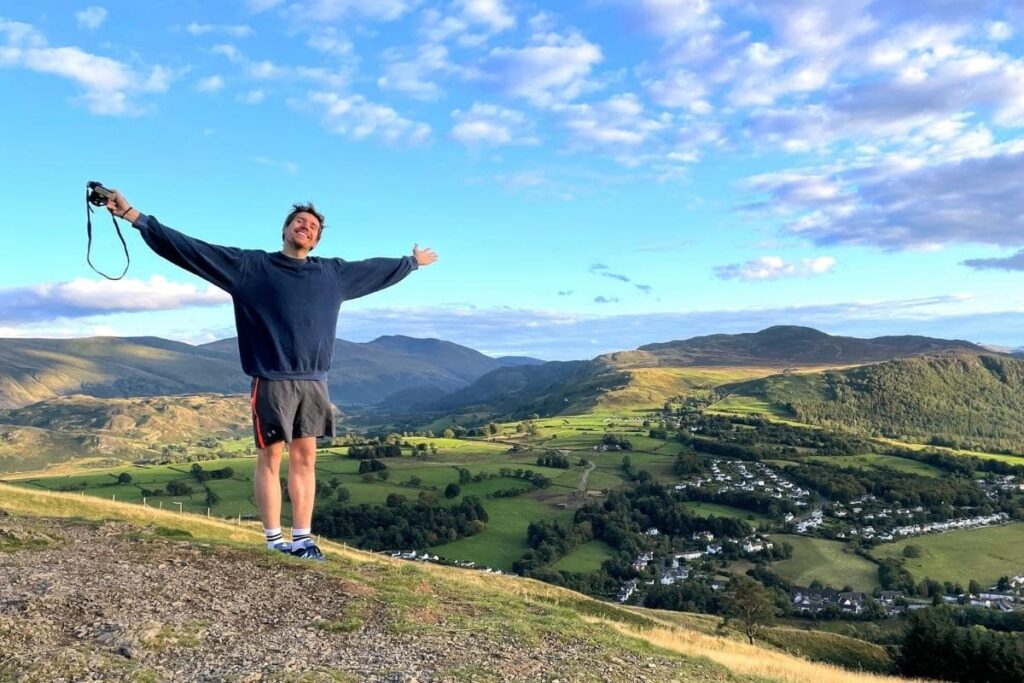
MEET THE AUTHOR!

Hi! I'm Jennie! As a part-time travel blogger based in London, I'm using my 10+ years of travel expertise to encourage & inspire you to step out of your comfort zone through sustainable, mindful and purposeful travel.
If I'm not writing, I'm either reading, drinking coffee or taking a wild swim (all at the same time if I'm feeling impressive).


Thank you for including so many easy walks. I love to walk but find most “hikes” are too much for me. These look wonderful and can’t wait to try some.